-
 Duration :18 Days
 -
 Group :Min 01- Max 20


Annapurna Circuit Trekking (NATT Trails) Trip Fact
-
 Trip Style : Trekking, Hiking and Culture Exploration
 -
 Trip Difficulty : Strenuous Hiking
 -
 Trip Guide : Guided Trekking
 -
 Destination : Annapurna, Nepal
 -
 Max Altitude : 5,416 Meters - 17,769Ft
 -
 Daily Walking Hours : Approx. 4-6 Hours Walking
 -
 Accomodation: Hotel & Lodges
 -
 Food : Breakfast, Lunch and Dinner
 -
 Start-End : Kathmandu/Chamje
 -
 Transport : Local Bus or Private Jeeps
 -
 Best Season : Feb to June and Sept to Dec
Annapurna Circuit Trekking (Natural Annapurna Trekking Trails)
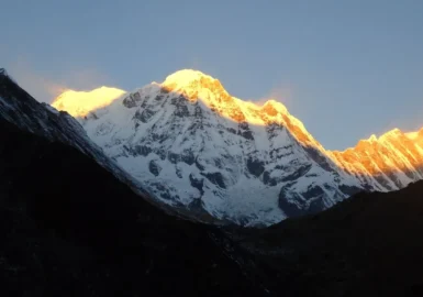
Annapurna circuit trekking is one of the most spectacular and fascinating treks within the Annapurna Himalayan range of central Nepal. This is a classic two to three-week popular trek in Annapurna that provides a magic blend of Himalayas exclusive cultures, scenery, and climate zones.
Natural Annapurna Trekking Trails starts from the lowland and rises to an altitude of 5416 m on the Thorong La pass, touching the edge of the Tibetan plateau. From the arid landscape of the Tibetan plateau to the world’s deepest Kali Gandaki gorge and the breathtaking view of the Annapurna massif and Tilicho Lake we are glad for choice in an extremely stunning region steeped in history, culture, religion, and tradition.
 1")
After you land in Nepal, you cannot miss exploring the ancient city of Kathmandu, where we will take you to explore the age-old monuments of Patan and Bhaktapur. The next day, we embark on Annapurna Natural trekking trails on a minibus and driving to the road ahead to Chamje and to the lush terrace fields of the lower Marsayangdi River valley.
We set foot on this trail and make our way alongside this ancient river as it cuts through the main Himalayan chain. Our companions during this trek will be bamboo and tropical vegetation. Soon the temperate climate makes its way to the arid desert and barren conditions of the Manang district, home to century-old Buddhist temples, medieval villages, and the native people, the Nyeshangs.
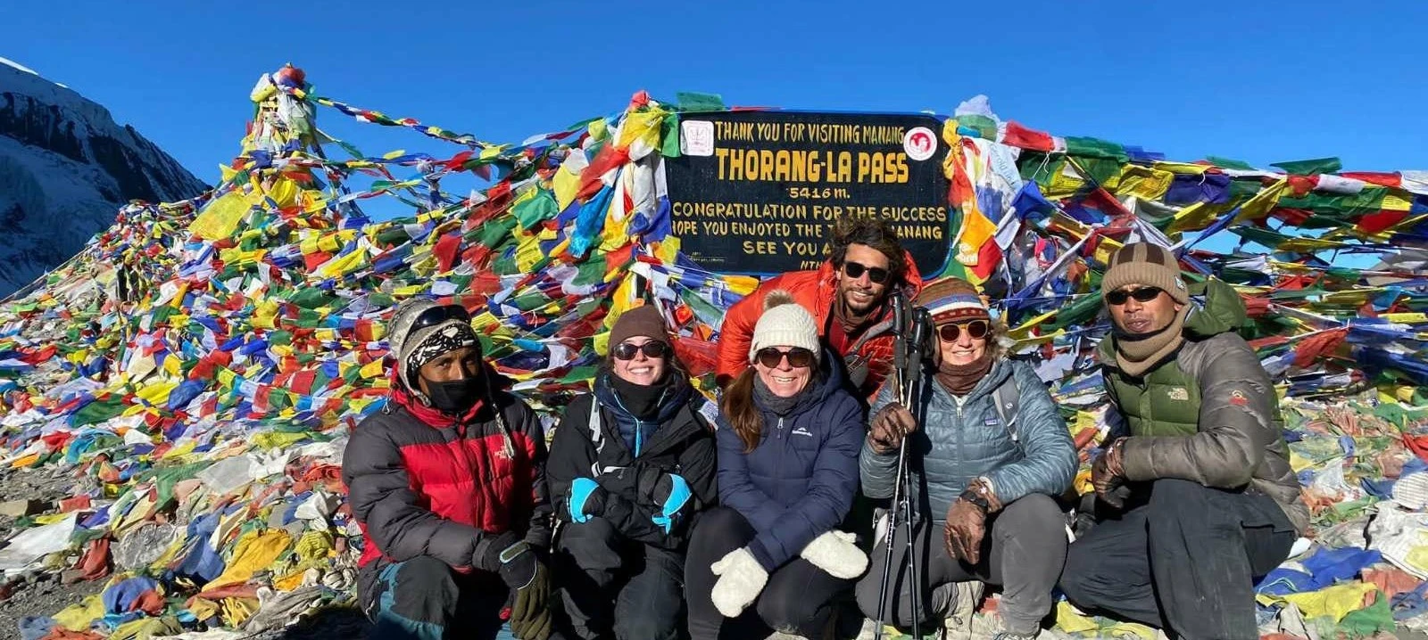
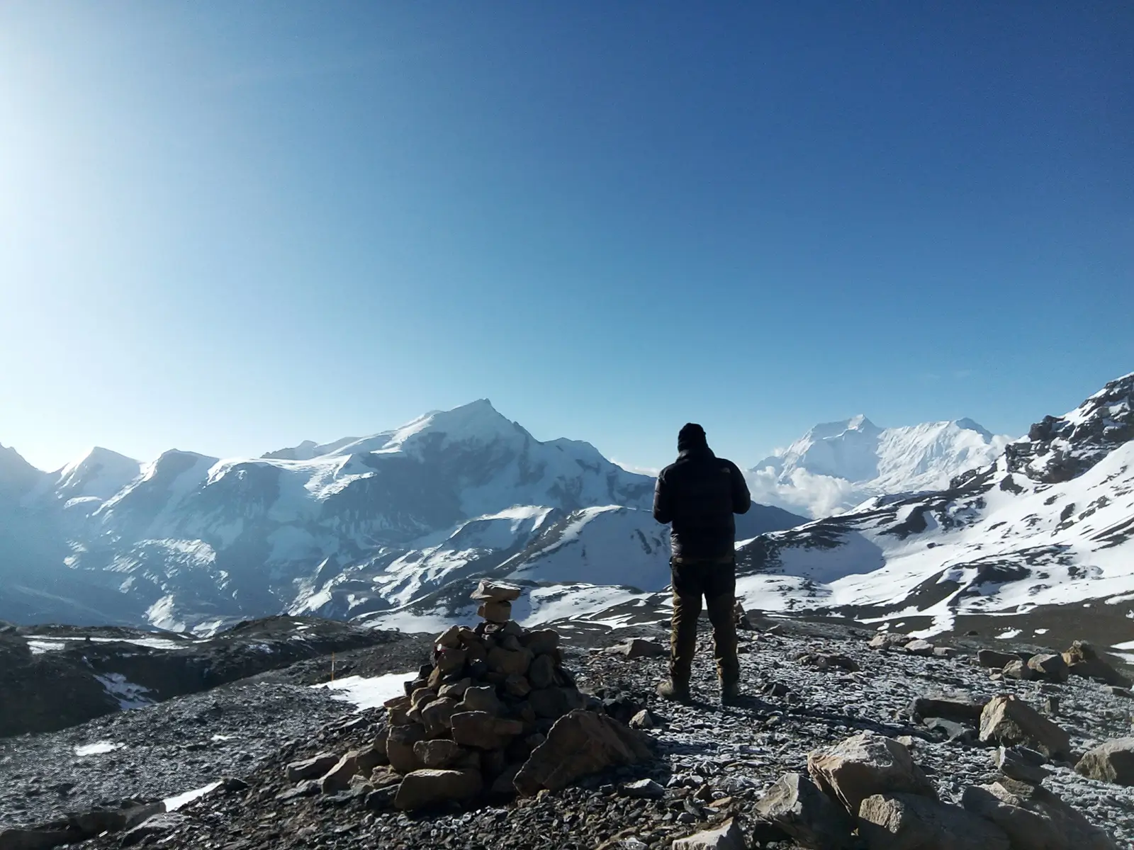
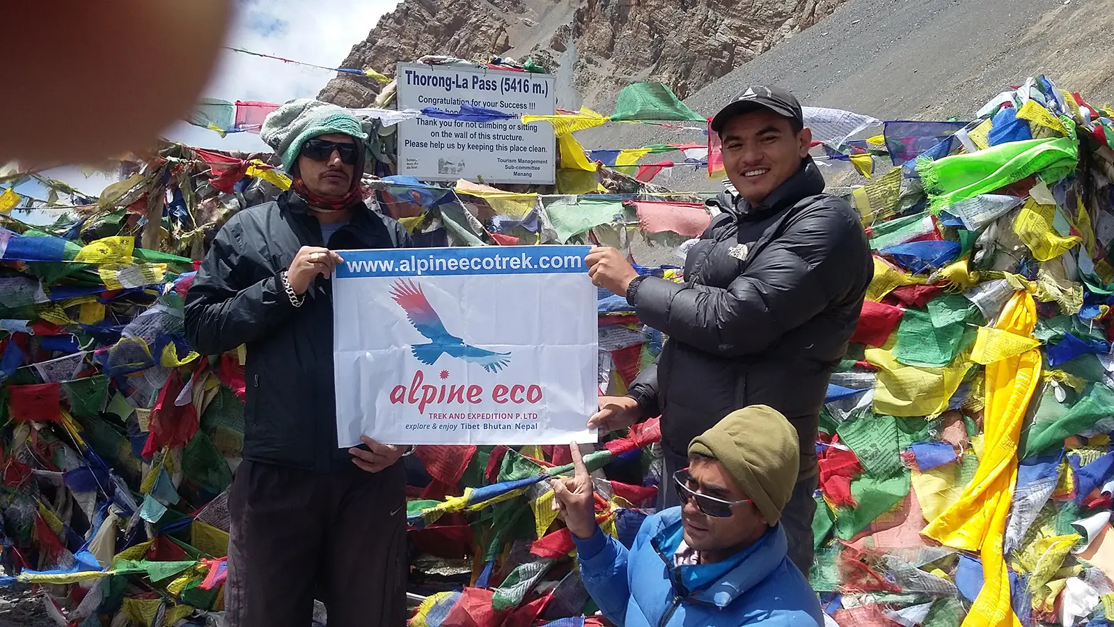
We set foot in the footsteps of the ancient salt traders over the highest pass in the world, the Thorong La pass. At 5,416m it is the highest trekking pass on earth and the spectacle from the top of Mt. Dhaulagiri (8,167m) is just stupendous. On the way down to the deepest gorge in the world, the Kali Gandaki gorge, we make a short visit to the holy temple of Muktinath, a sacred site for both Hindus and Buddhists. Witness how the locals indulge themselves while devoting themselves to God.
 2")
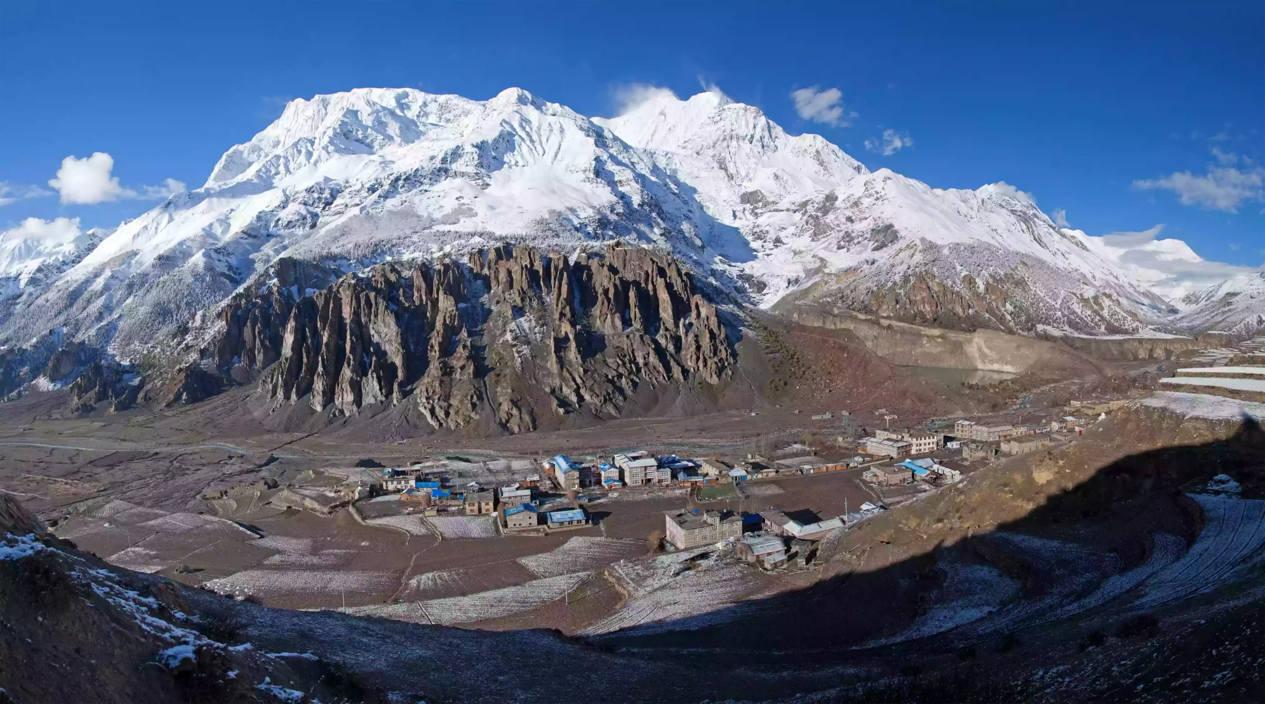
As we continue our descent, we arrive at Kagbeni and the junction of the Jhong Khola and Kali Gandaki Rivers (2,800). Eventually, we will end up in the deepest valley in the world. Surrounding us to the east is the splendid Annapurna (8,031m) which majestically sits astride the gorge, and on the west lies the towering peak of Dhaulagiri at 8,167m. Like sentinels of the rapidly flowing Kali Gandaki River, they guide us south towards the lush lowlands.
Continuing walking from Jomsom down to Tatopani and Ghorepani Poon Hill through natural trekking trails. As we descend through the trails, we will be surrounded by the cool winds of the pine and rhododendron forests which will lead us to the natural hot springs. Soak away the dust of the trail, revitalize, rejuvenate and relax. We also make a short ascent to the peak of the unmissable Poon Hill for the stunning and great views when the sun rises and the sun rays gently caress the mountain peaks. This a final reminder that you have just circumnavigated one of the most breathtaking mountain ranges on earth.
 3")
Trip Highlights
- Annapurna circuit 13 days is the most popular classic trek in the Annapurna region
- The trek will be organized from Kathmandu, anyone with good physical fitness can easily join the trek
- The trek leads to the Manang village, Tilicho Lake and Thorong La pass to Muktinath and Jomsom walking through terrace farming lands, traditional villages, cool and refreshing jungles crossing several bamboo bridges and waterfalls.
- This is the second most popular and famous trek in Nepal
- Explore a magic blend of beautiful landscapes and nature of the central Himalayan region of Nepal
- Enjoy the breathtaking views of the splendid Himalayan panorama of Annapurna massif, Mt. Manaslu, Mt. Fishtail, Mt. Nilgiri, Mt. Hinchuli and several other Midwestern Himalayan giants of Nepal
- Experience the diverse ethno-culture, lifestyles, topography on the shadow of incredible mountain vistas
-
Outline Itinerary
- + Show More
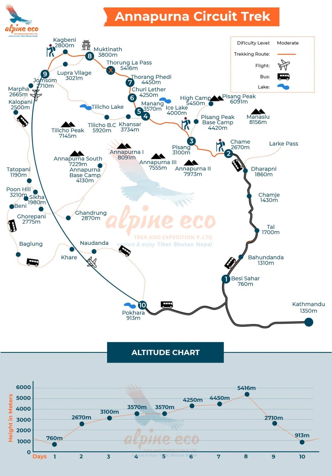
Drive on a 4WD from Kathmandu to Chamje (1,410m): 8-9 hours. Overnight at guest house with breakfast, lunch, dinner and tea/coffees.
-
Accommodation: Guesthouse
-
Meals: Breakfast, Lunch and Dinner
-
 Place: Chamje
-
Maximum Altitude:1,410m
Trek from Chamje to Dharapani (1,960m): 5 - 6 hours. Overnight at guest house with breakfast, lunch, dinner and tea/coffees.
-
Accommodation: Guesthouse
-
Meals: Breakfast, Lunch and Dinner
-
Place: Dharapani
-
Maximum Altitude:1,960m
Trek from Dharapani to Chame (2,710m): 5 - 6 hours. Overnight at guest house with breakfast, lunch, dinner and tea/coffees.
-
Accommodation: Guesthouse
-
Meals: Breakfast, Lunch and Dinner
-
Place: Chame
-
Maximum Altitude:2,710m
Trek from Chame to Pisang (3,300m): 5 - 6 hours. Overnight at guest house with breakfast, lunch, dinner and tea/coffees
-
Accommodation: Guesthouse
-
Meals: Breakfast, Lunch and Dinner
-
Place: Pisang
-
Maximum Altitude:3,300m
Trek from Pisang to Manang (3,500m): 6 - 7 hours. Overnight at guest house with breakfast, lunch, dinner and tea/coffees.
-
Accommodation: Guesthouse
-
Meals: Breakfast, Lunch and Dinner
-
Place: Manang
-
Maximum Altitude:3,500m
Rest day in Manang Village. Day hike to Ice Lake and Gangapurna Lake. Overnight at the guest house with breakfast, lunch, dinner and tea/coffees
-
Accommodation: Guesthouse
-
Meals: Breakfast, Lunch and Dinner
-
Place: Manang
-
Maximum Altitude:3,500m
Trek from Manang to Khangsar (3745m): 2-3 hours. Overnight at guest house with breakfast, lunch, dinner and tea/coffees.
-
Accommodation: Guesthouse
-
Meals: Breakfast, Lunch and Dinner
-
Place: Khangsar
-
Maximum Altitude:3,745m
Trek from Khangsar to Tilicho Base Camp (4140m): 5-6 hours. Overnight at guest house with breakfast, lunch, dinner and tea/coffees.
-
Accommodation: Guesthouse
-
Meals: Breakfast, Lunch and Dinner
-
Place: Tilicho Base Camp
-
Maximum Altitude:4,140m
Explore Tilicho Lake (4,949m) then trek back to base camp: 5-6 hours. Overnight at guest house with breakfast, lunch, dinner and tea/coffees.
-
Accommodation: Guesthouse
-
Meals: Breakfast, Lunch and Dinner
-
Place: Tilicho Lake
-
Maximum Altitude:4,949m
Trek from Tilicho Base Camp to Yak Kharka (4040m): 4-5 hours. Overnight at guest house with breakfast, lunch, dinner and tea/coffees.
-
Accommodation: Guesthouse
-
Meals: Breakfast, Lunch and Dinner
-
Place: Yak Kharka
-
Maximum Altitude:4,040m
Trek from Yak kharka to Thorang Phedi: (4420m): 3-4 hours. Overnight at guest house with breakfast, lunch, dinner and tea/coffees.
-
Accommodation: Guesthouse
-
Meals: Breakfast, Lunch and Dinner
-
Place: Thorang Phedi
-
Maximum Altitude:4,420m
Trek from Thorong Phedi to Muktinath (3,800m) via Thorong La pass (5416m): 7 - 8 hours. Overnight at guest house with breakfast, lunch, dinner and tea/coffees.
-
Accommodation: Guesthouse
-
Meals: Breakfast, Lunch and Dinner
-
Place: Thorong Pass - Muktinath
-
Maximum Altitude:5,416m / 3,800m
Trek from Muktinath to Lubra and to Jomsom and then to Marpha ( 2500m): 5 to 6 hours. Overnight at Guest house with breakfast, lunch, dinner and tea/coffees.
-
Accommodation: Guesthouse
-
Meals: Breakfast, Lunch and Dinner
-
Place: Marpha
-
Maximum Altitude:2,500m
Trek from Marpha to Kokkethati ( 2300m): 6 to 6 hours. Overnight at Guest house with breakfast, lunch, dinner and tea/coffees.
-
Accommodation: Guesthouse
-
Meals: Breakfast, Lunch and Dinner
-
Place: Kokkethati
-
Maximum Altitude:2,300m
Trek from Kokkethati to Dana ( 2100m): 5 to 6 hours. Overnight at Guest house with breakfast, lunch, dinner and tea/coffees.
-
Accommodation: Guesthouse
-
Meals: Breakfast, Lunch and Dinner
-
Place: Dana
-
Maximum Altitude:2,100m
Trek from Dana to Tatopani (1900m): (2,5 hours) + hot springs. Overnight at Guest house with breakfast, lunch, dinner and tea/coffees.
-
Accommodation: Guesthouse
-
Meals: Breakfast, Lunch and Dinner
-
Place: Tatopani
-
Maximum Altitude:1,900m
Trek from Tatopani to Ghorepani ( 2800m): 5 to 6 hours. Overnight at Guest house with breakfast, lunch, dinner and tea/coffees.
-
Accommodation: Guesthouse
-
Meals: Breakfast, Lunch and Dinner
-
Place: Ghorepani
-
Maximum Altitude:2,800m
Hike Poon Hill early morning, after sunrise, back to the Guest house, pack and trek down to Tikhedunga, take a jeep from here to Pokhara. Service ends
-
Accommodation: Hotel on your own
-
Meals: Breakfast and Lunch
-
Place: Tikhedunga / Pokhara
-
Maximum Altitude:1,600m / 8,10m
Map of This Trek
-
PRICES & DATES
Have a question ?
Please call us on +977 98510 36844 to talk about your adventure or chat with Ram Kumar on WhatsApp (Available 24hrs) for best quote and detailed information. Transfer from Kathmandu to Trekking Starting point Chamje
- Annapurna Conservation fee with trekking permit.
- Tims card (trekking information management system card).
- Meals and Lodge accommodations during the trekking period.
- Teahouse accommodation (Teahouse) during the trekking period.
- English speaking guide and highly experienced staff.
- Staffs food, clothing, salary and their insurance.
- All necessary grounded transportation.
- Medical supplies (first aid kit will be available).
- Arrangement of Emergency Helicopter service which will be paid by your Travel insurance company.
- Welcome dinner in Kathmandu served by Ram Kumar.
- Our service charges with VAT and Local / Government Taxes.
 Hotel in Kathmandu and Pokhara
- Sightseeing or any extra activities except the above program.
- Personal nature expenses.
- Bar bill and all kind of drinks.
- Rescue & Evacuation.
- Gratitude (tip) for staff.
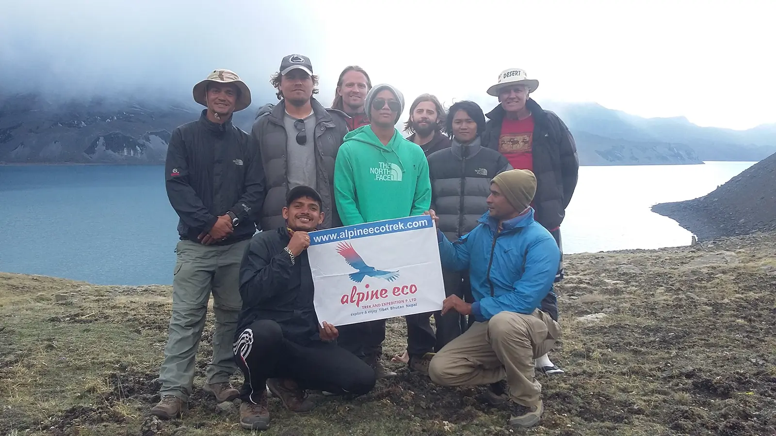
Photo Gallery

Useful Information
Annapurna Circuit Trekking (A classic trek in the Annapurna Region); being a tea-house trek, each and every stop provides decent guesthouses and mountain lodges. As for the local’s needs and accessibility, there is the road from Besishar to Manang has been built now, this means the trek is badly affected by the road but no problems will arise as we will be following a different trail to skip the road. The very famous and beautiful trail is called NATT trail (New Annapurna Trekking Trails) which is the best and most peaceful trekking trail on the Annapurna circuit trek that skips the entire road walk. We have been conducting the Annapurna circuit trek package as a small group departure or a private trek. Contact us for letting us know how many of you are there in your group to do this trek so that we can provide you with the cost and other information according to your group size.
Required Permits
Annapurna circuit trekking requires two permits to enter the region. The first one is the Annapurna Conservation Area Permit (ACAP) and the second one is Trekker’s Information Management System card (TIMS). We organize both permits in Kathmandu with your passport details.
Your Trek Bag: Your trek bag, and duffel bags will be carried by our porters. 1 porter for 2 clients and our porter can carry up to 20 kilograms.
Trip Orientation
About 6 hours drive from Kathmandu to Besishar and then 3 hours local jeep drive to Chamje from where the real adventure begins with our guide and porters. Trek from Chamje, Pisang to Manang, Tilicho Lake, Thorong Phedi, Thorong La pass, Muktinath, Jomsom via Lubra village and then to Tatopani and Poon Hill. 17 nights guesthouse accommodation based on breakfast, lunch and dinner.
-
FAQs
- + Show More
 Share
Share
 Starting From:
We offer Group Discount
-
Local Experts
Happiness Guaranteed
-
Easy Payment Options
Book with confidence
Trip Reviews
We take great pride in taking care of our guests
-
December 27, 2022
Annapurna Circuit Trek
When I was planning my first trekking trip to Nepal, from Australia, I approached several trekking companies. Alpine Eco – Ram Kumar was the only one responded to my email promptly. I had an amazing time with Sharan and Shambu as a porter and guide. They were honest, friendly and looked after me. I felt safe. I will be going back again with my family. It was awesome.
-
Jeyamony H
Australia

Customize This Trip
Tell us your travel plans and preferences and we will design the best trip match for you. Or Give us a call, we are at your service!

Ram Kumar Adhikari
Manager/Owner
Sangita Adhikari
Management Head
Ram Gopal Adhikari
Trip Co-ordinator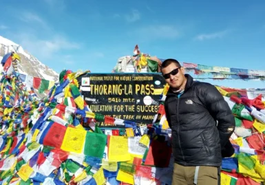

Trip Advisor Recognations
Our goal at Alpine Eco Trek is to deliver the most unforgettable and epic journeys to our clients. We create memories that are to be remembered for a lifetime. Memories you can be proud of and can share with everyone around you...


Plan Your Dream Trip with Us
Tell us your interests and travel plans, we'll design the best trip match for you.
Ram Kumar Adhikari
Manager/Owner
Sangita Adhikari
Management Head
Ram Gopal Adhikari
Trip Co-ordinatorNeed a Reference ?
![]() Hermosa Beach, CA 90254
Hermosa Beach, CA 90254
![]() Redondo Beach, CA
Redondo Beach, CA
-
Associations:
-
-
-
-

-

-
Sister Concern:
-
-